This project uses Meshtastic software and LoRa radios. Meshtastic is what is called an open-source software development. This means that it is developed by and maintained by users and is fully available to use and modify by anyone, for free.
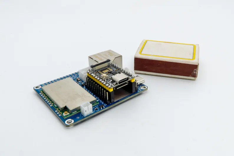
LoRa radios operate in the ISM band at 902-928MHz. ISM band is a part of the radio spectrum that can be used for any purpose without a license in most countries. They are low-power, inexpensive, compact radio devices that are used for a text only mesh network communications system. The communications circuit board is the size of a matchbox.
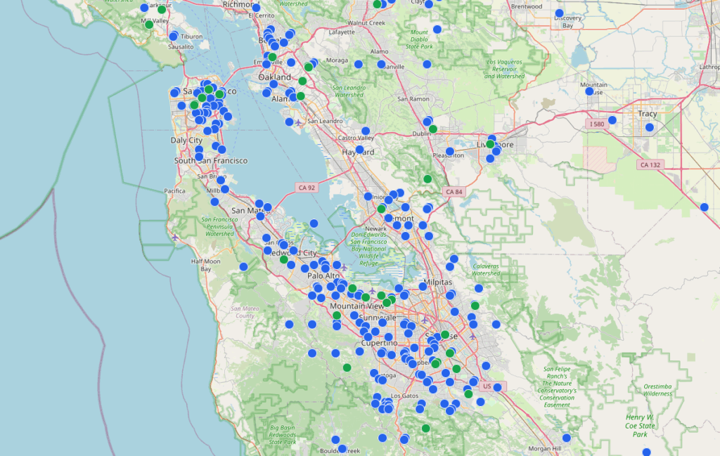
There are over 40,000 nodes deployed worldwide at this time. There are over 500 nodes in the San Francisco bay area alone.
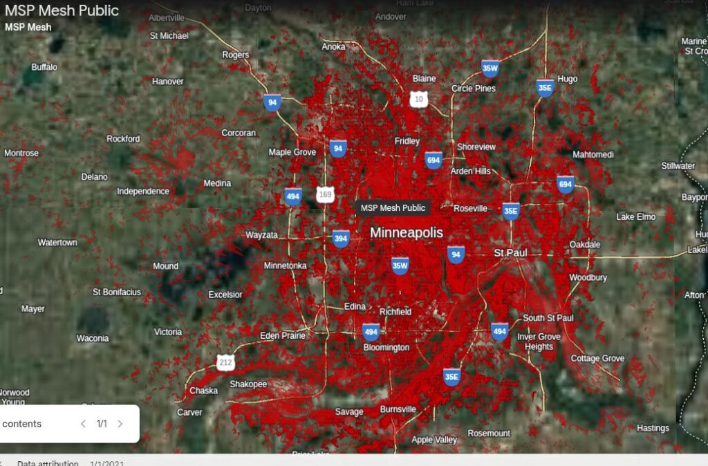
Minneapolis has 300 nodes at this time.
www.Meshtastic.org
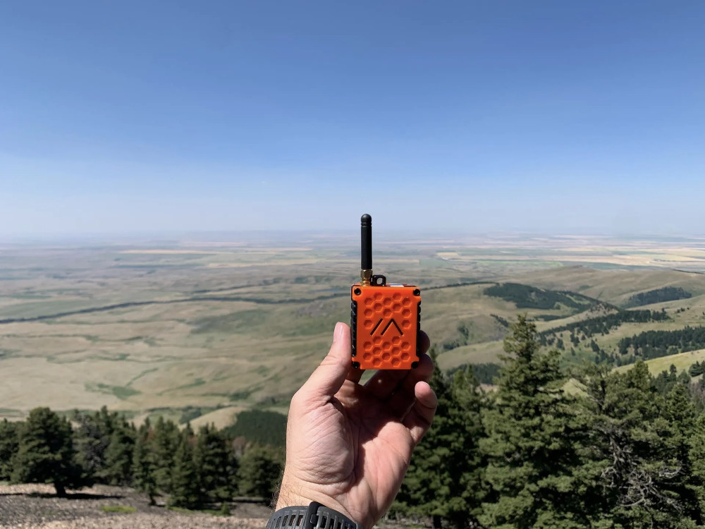
A typical radio or “node” is a small box with a solar panel. A common cell phone is used to connect with the node via bluetooth. An app is used to “text” in a similar way to texting with a cell phone except no cell phone connection or internet connection is used.

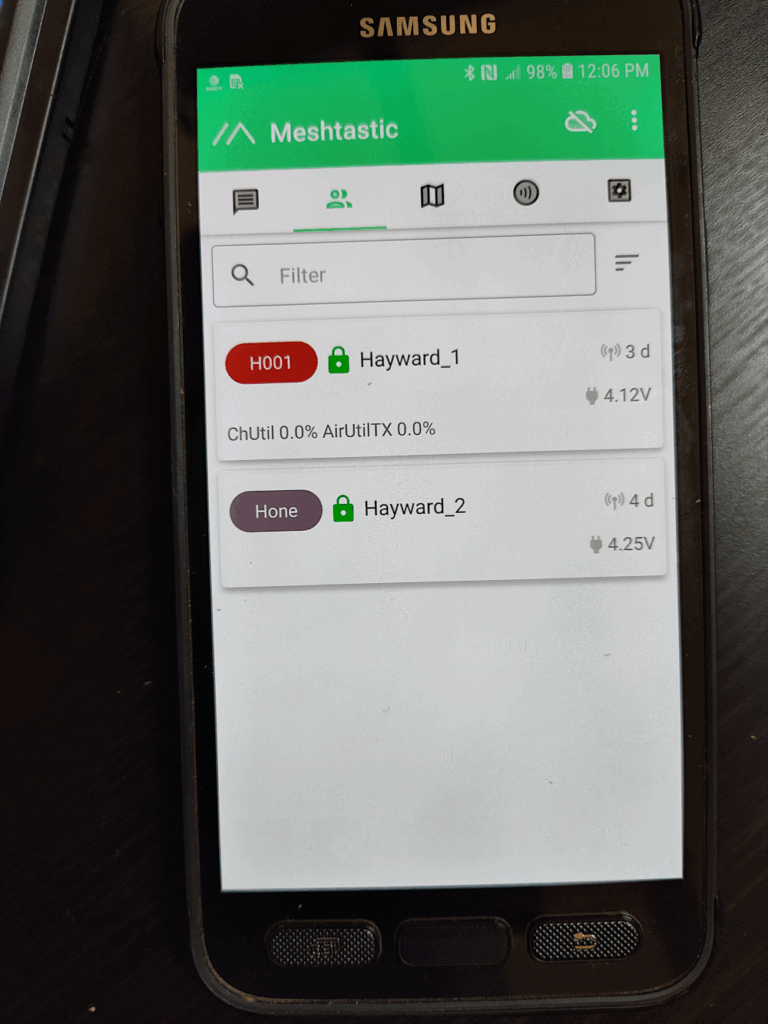
Other users may opt for a stand-alone device with touch screen and no need for a cell phone at all.


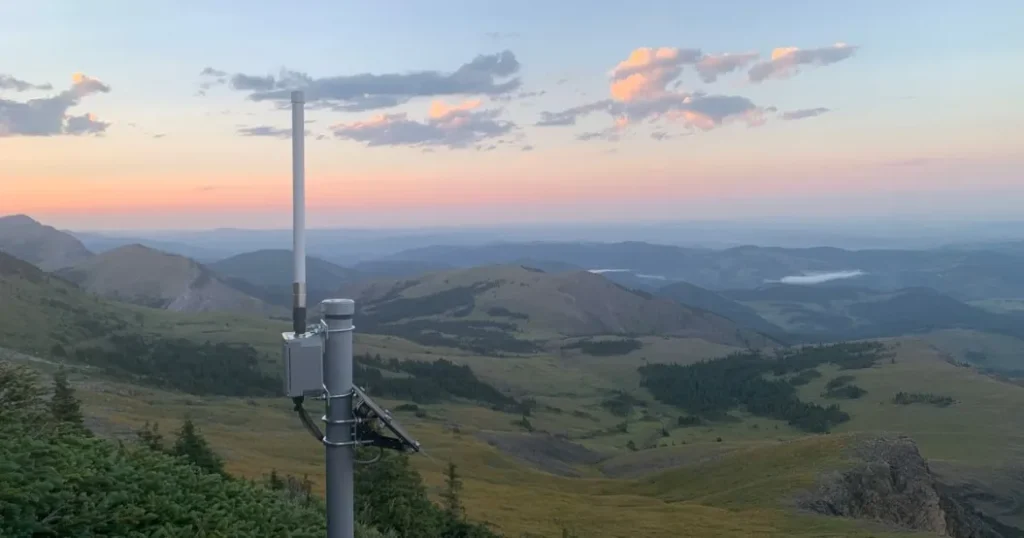
Design tools are available to analyze the path between hills to determine if there is a line-of-sight view. Path analysis between Hayward and Telemark is below:

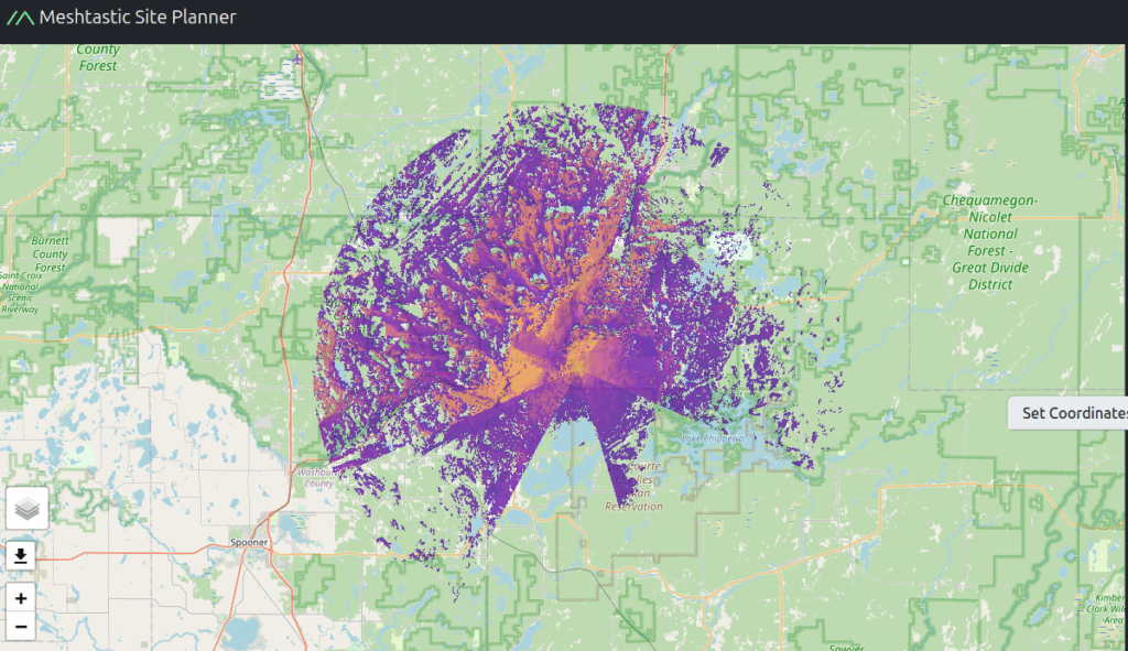
Site planner tools analyze the terrain and plot the predicted coverage from a high point to the surrounding countryside of the hill-top radio transmitters. Coverage simulation map of Hayward below: